Exhibition : To each his own! Visit BACK

To each his own!

To each his own!

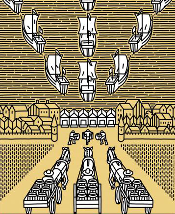
Digging, clearing, building roads, bridges, cities: from time immemorial, men have never ceased to explore the possibilities of developing their territory. Through a selection of 30 objects from preventive excavations conducted by the Inrap in Brittany around Corseul (Côtes d'Armor) and ancient collections, this exhibition offers you a focus on the Roman road, an essential vector of the economic life of the territories during antiquity.

At that time, a vast road network was set up on the scale of the Roman Empire. Connected to river and sea routes, it favored exchanges and trade and allowed the diffusion of cultural modes and practices.

© Arthur Bonifay, Travaux pratiques / Inrap

Corseul,

a city in the Roman Empire

Corseul,

a city in the Roman Empire

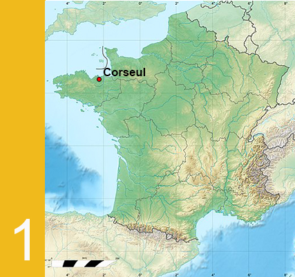
Corseul, today a simple town in the Côtes-d'Armor, was in antiquity an important city, the chief town of the city of Coriosolites!!

After the conquest of Gaul by Caesar's legions in 52 BC, the territory of the Coriosolites loses its independence and is attached to the Roman Empire. The city of Corseul (Fanum Martis) was then created, at the same time as a vast road network was developed on the scale of the Empire, made up of roads of varying importance.

The main roads played above all a military role: they allowed the rapid movement of the legions in the event of troubles. They also serve as administrative links, supporting in particular the routing of the mail of the imperial post. Thanks to these roads, Corseul was linked to the other administrative capitals of Armorica: Vannes (Darioritum), Carhaix (Vorgium), Rennes (Condate), as well as to other major cities like Avranches (Legedia).

Secondary roads, sometimes simple dirt roads, served the countryside and linked secondary settlements, ports and large agricultural estates, promoting local trade.

This terrestrial network was connected to waterways used for the import of distant products, such as wine or oil from Spain.

© Wikipédia

The Peutinger table

The Peutinger table

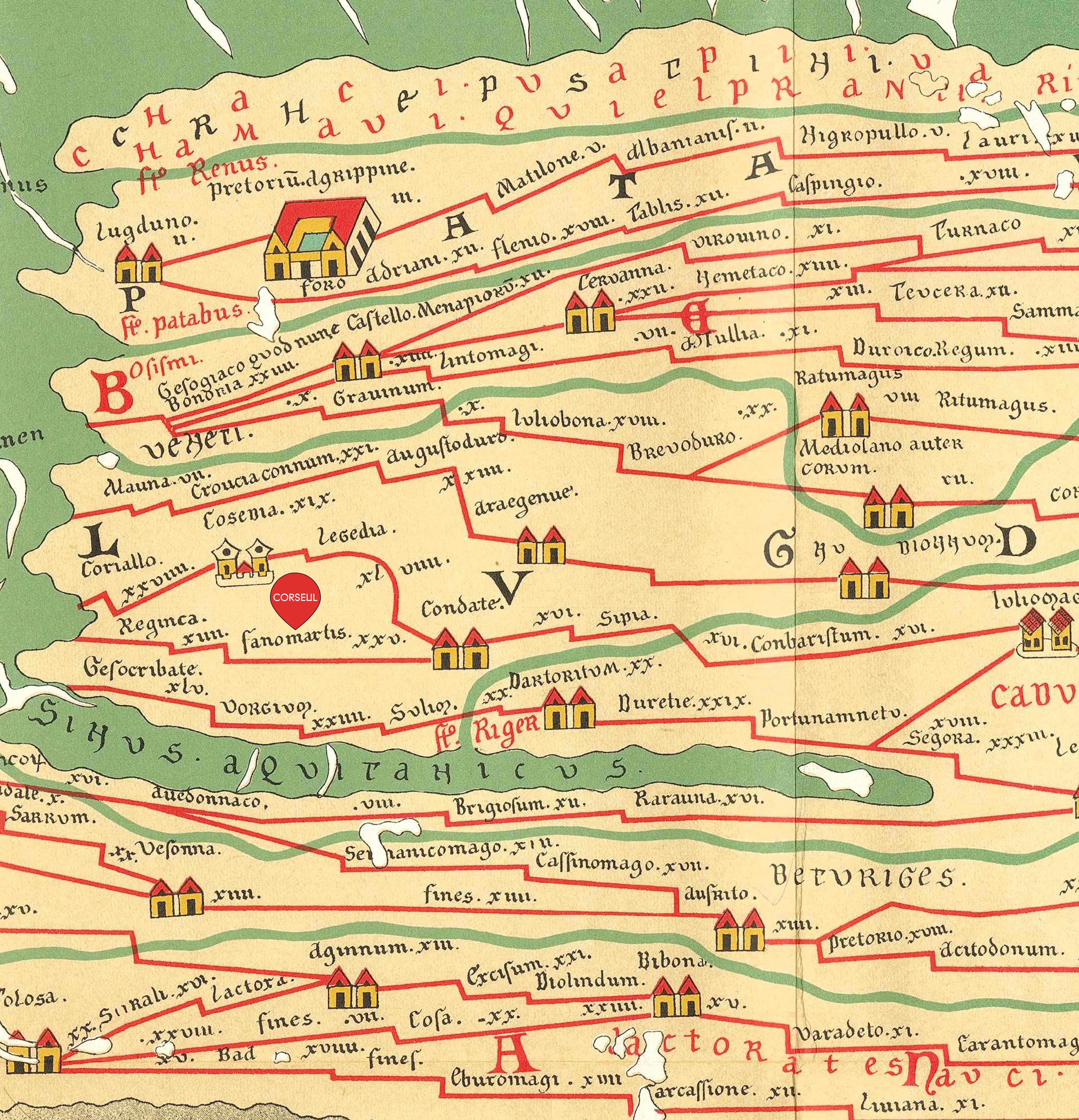
The Peutinger table is a 13th century copy of an ancient Roman map, on which the main roads and cities of the Roman Empire are shown, as well as some points of interest: lighthouses, sanctuaries, etc.

Schematically, this cartographic representation of the road network (200,000 km!) indicates the distances between stations and allows one to organize one's itinerary.

Corseul (or perhaps its sanctuary?) appears on this map under the name Fanomartis.

Illustration : d'après Desjardins, 1869

Traveling under the protection of the gods

Traveling under the protection of the gods

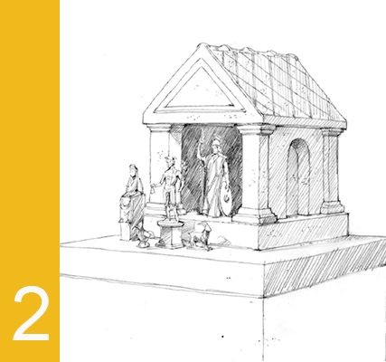
Amulets and other protective objects are part of everyday life in Roman antiquity. In Gaul, the deities know many regional variants whose origins are well before the Conquest. They are sometimes associated with the main gods of the Roman pantheon, such as Mercury, who alone can protect, help, bring luck or inspire the inhabitants of Roman Gaul in many occasions: travel, trade, prosperity or craft activity. Animals such as the rooster and the goat are attached to him.

Illustration : dessin noir et blanc du laraire
© Benoît Clarys

On foot, on horseback or by wagon...

On foot, on horseback or by wagon...

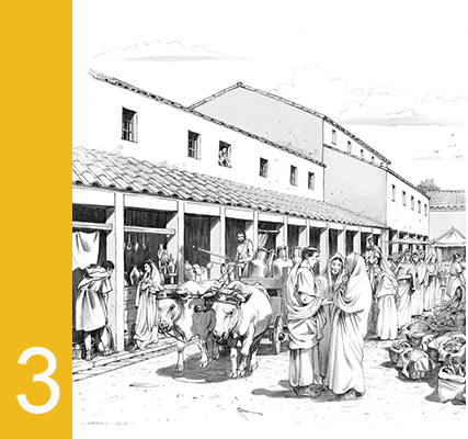
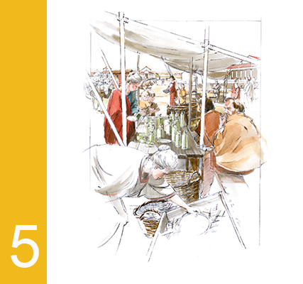
The Romans developed a wide variety of vehicles to travel or trade. Travel was done on foot, on horseback or by carriage. The imperial mail was carried by horsemen who could travel up to 80 km per day. Light two-wheeled vehicles were used for the rapid transport of up to two people. Four-wheeled carriages with benches carried several passengers sitting back to back. These carriages are pulled by horses, donkeys or even oxen for the heaviest goods.

Illustration : Marché de Condate
© Olivier-Marc Nadel

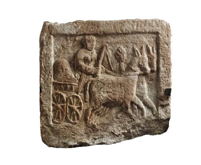
Example of a hitch

Example of a hitch

Painted and sculpted representations give an account of the diversity of modes of travel.

© Musée de Strasbourg

Roadhouses and inns to stop over at

Roadhouses and inns to stop over at

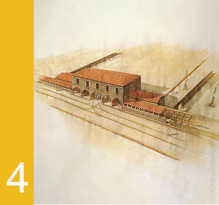
In Roman antiquity, stations mark the road axes. Distant from 10 to 15 kilometers, they allow the rest of the travelers and their mounts, as well as the maintenance of the vehicles at the time of great displacements.Some stations are simple road stations permitting to make a pause. The best equipped ones allow you to spend the night. There is an inn for board and lodging, a stable service for the rest of the mounts, a farrier, even a wheelwright in charge of the maintenance of the vehicles and even sometimes baths or a temple!

Illustration : Auberge de Bordeaux 
© Bassilis Kaffetzakis

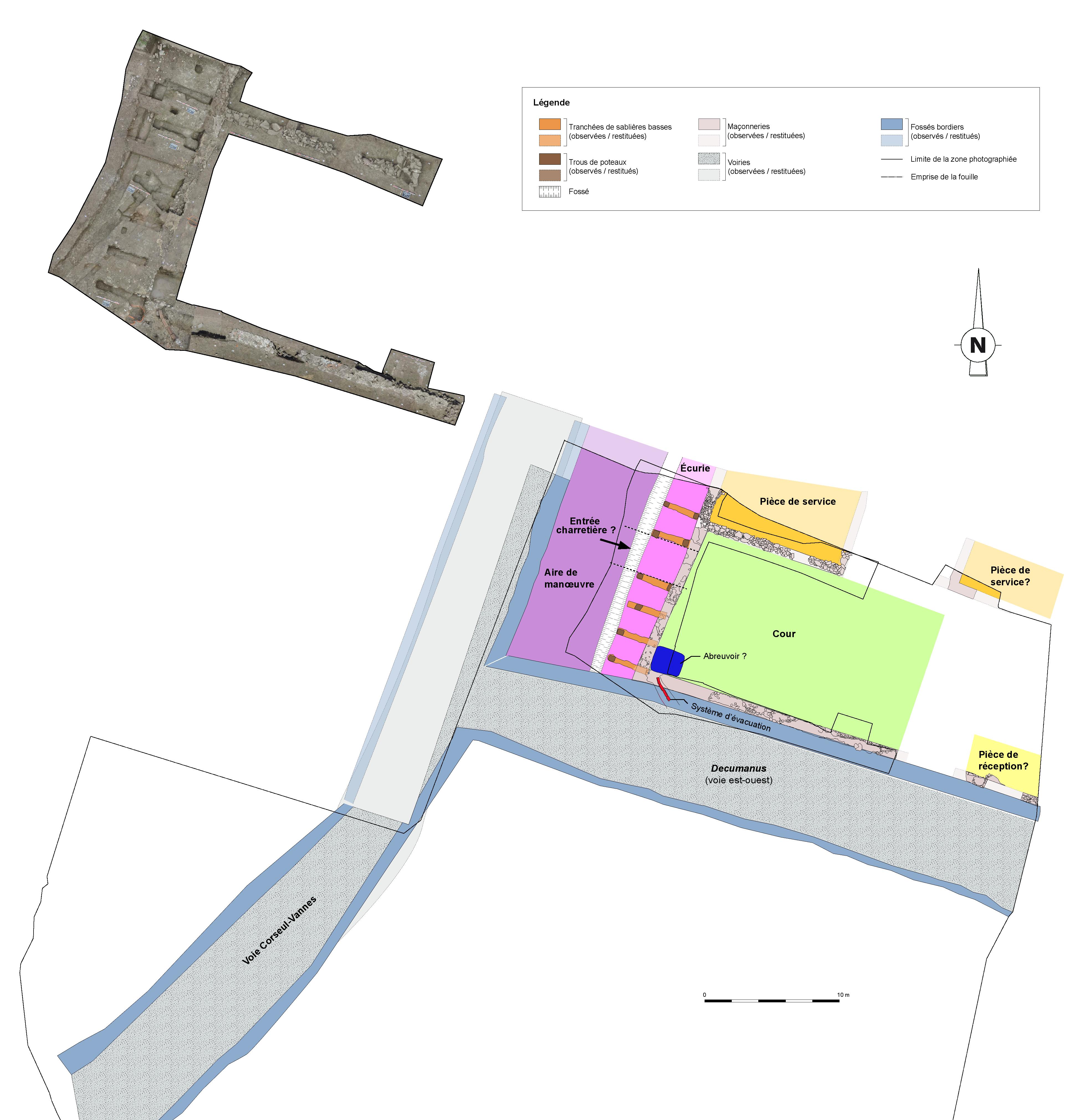
Map of the Inn of Corseul

Map of the Inn of Corseul

In Corseul, on the Val de Gravel site, Inrap archaeologists have uncovered the remains of an inn at the southern entrance to the town, at the intersection of the Corseul-Vannes road and a decumanus (east-west oriented street). This building consists of a set of spaces and facilities dedicated to the reception of travelers, but also to the care of their mounts and vehicles: service rooms, a possible reception room heated by the floor, a stable, a drinking trough, a cart entrance, a maneuvering area as well as a vast enclosed courtyard. The numerous finds (fragments of tableware and wine amphorae, coins, elements of harnessing, etc.) indicate that the inn was in use between the 1960s and 150 AD.

© Equipe Inrap

Trade and commerce

Trade and commerce

The existence of a vast road network undoubtedly favored the transit of many raw materials throughout the Roman Empire. Thus, archaeologists often highlight imports of marbles, glass ingots intended for local glassmakers to make vessels and windows, or alum used by dyers and leather craftsmen.

Similarly, the network allowed the circulation of consumer goods very varied. Some are exchanged between nearby regions, such as kitchen ceramics, cereals or market garden produce. Others are transported over long distances, for example tableware made of sigillata, amphorae used to transport wine, oil, condiments or certain luxurious objects made in Italy and transported to Corseul. These long-distance trade routes were mapped by archaeologists.

Illustration : Marché d'Avenches
© Benoît Clarys

To each his own!

To each his own!

Most of the objects were exhibited as part of "Each to his own! Archaeology of land development", an exhibition designed around an Inrap Archaeocapsule and presented at Coriosolis - Heritage Interpretation Center (Dinan Agglomeration) from August 1 to October 31, 2020.

Digital exhibition produced by Inrap in 2021.
Stéphanie Hurtin, archaeological collections manager
Sandrine Lalain, cultural development and communication officer
Camille Lavenu, cultural development and communication officer

Inrap scientific referents:
Romuald Ferrette, archaeologist
Gilles Leroux, archaeologist
Nicolas Ménez, archaeologist
Richard Delage, ceramologist
Gaétan Le Cloirec, archaeologist
Françoise Labaune-Jean, ceramologist
Pauline Petit, specialist in furniture-instrumentum
Stéphanie Raux, specialist in furniture-instrumentum
Laure Simon, ceramologist

Acknowledgements :
Emmanuelle Collado, Inrap
Matthieu Giffrain and Roxane Meylan, Dinan Agglomeration
Manon Six, Musée de Bretagne
Direction Régionale des Affaires Culturelles de Bretagne, Service Régional de l'Archéologie
Dinan Agglomeration and Coriosolis, heritage interpretation center
Musée de Bretagne
Laurent Pelletier, in charge of management and conservation of archaeological collections, Inrap-scientific and technical department, head of the Galerie Muséale Inrap project